
Biggest Bodies Of Water....After Ocean
What Is Sea?
A sea generally refers to a large body of salt water, but the term is used in other contexts as well. Most commonly, the term refers to a large expanse ofsaline water connected with an ocean, and is commonly used as a synonym for ocean. It is also used sometimes to describe a large saline lake that lacks a natural outlet, such as the Caspian Sea.
What Is Bay?
A bay is an area of water mostly surrounded or otherwise demarcated by land. Bays generally have calmer waters than the surrounding sea, due to the surrounding land blocking some waves and often reducing winds. It can also be an inlet in a lake or pond.
What Is Gulf?
A gulf is a large bay that is an arm of an ocean or sea.
Biggest Bodies Of Water After Ocean
Number1
2 3 4 5 6 7 8 9 10 11 12 13 14 15 16 17 18 19 |
|
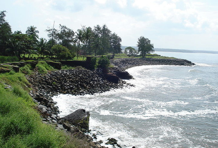
Arabian Sea as seen from Kannur Fort, Kannur, Kerala
Arabian Sea
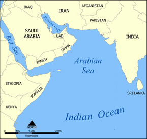
The Arabian Sea (Arabic: بحر العرب ,Baḥr al-'Arab; Kannada: ಅರೇಬಿಯಾ ಸಮುದ್ರ,Arabia samudra; Marathi: अरबी समुद्र, (Arabi samudra); Malayalam: അറബിക്കടല്, Aṟabikkadal; Persian: دریای عرب,Darya-ye ʿArab) is a region of the Indian Ocean bounded on the east by India, on the north by Pakistan and Iran, on the west by the Arabian Peninsula, on the south, approximately, by a line between Cape Guardafui in the northeastern Somalia and Kanyakumari (Cape Comorin) in India. Some of the ancient names of this body of water include Sindhu Sagar (Sea of Sindh) and Erythraean Sea.It is world 6th bodies of water by size and area.
The Arabian Sea's surface area is about 3,862,000 km2 (1,491,130 sq mi).The maximum width of the Arabian Sea is approximately 2,400 km (1,490 mi), and its maximum depth is 4,652 metres (15,262 ft), in the Arabian Basin approximately at the same latitude as the southernmost tip of India. The largest river flowing into the Arabian Sea is the Indus River; others include the Netravathi, Sharavathi, Narmada, Tapti, Mahi, and the numerous rivers of Kerala. The Arabian Sea coast of central India is known as the Konkan Coast, and that of southern India is known as the Malabar Coast.
The Arabian Sea has two important branches the Gulf of Aden in the southwest, connecting with the Red Sea through the strait of Bab-el-Mandeb; and the Gulf of Oman to the northwest, connecting with the Persian Gulf. There are also the gulfs of Cambay and Kutch on the Indian coast. The largest islands in the Arabian Sea are Socotra (off the Horn of Africa) and Masirah (off the Omani coast) as well as the Lakshadweep archipelago off the Indian coast.The countries with coastlines on the Arabian Sea are Somalia, Djibouti, Yemen, Oman, Iran, Pakistan, India and the Maldives.
There are several large cities on the Arabian Sea coast including Aden, Muscat, Karachi, Surat, Mumbai, Mangalore, Kozhikode, Kochi and Thiruvananthapuram.
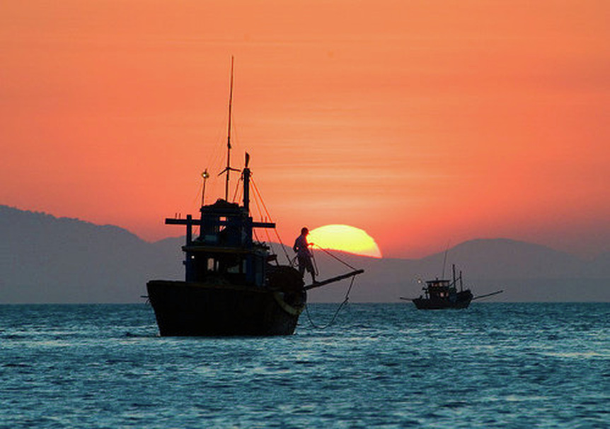
Sunset on the South China Sea off Mui Ne village on the south-east coast of Vietnam
South China Sea
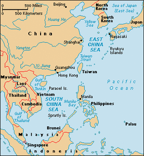
The South China Sea is a marginal sea that is part of the Pacific Ocean, encompassing an area from the Singapore and Malacca Straits to the Strait of Taiwan of around1,148,000 sq mi (2,973,306 km2). Depending on measurement, it is the largest or second largest body of water after the five oceans.
It is located south of China and Taiwan,west of the Philippines,north west of Sabah (Malaysia), Sarawak (Malaysia) and Brunei,north of Indonesia,north east of the Malay peninsula (Malaysia) and Singapore, and east of Vietnam.The minute South China Sea Islands, collectively an archipelago, number in the hundreds. The sea and its mostly uninhabited islands are subject to competing claims of sovereignty by several countries. These claims are also reflected in the variety of names used for the islands and the sea.
States and territories with borders on the sea (clockwise from north) include: the People's Republic of China (including Macau and Hong Kong), the Republic of China (Taiwan), the Philippines,Malaysia, Brunei, Indonesia, Singapore, and Vietnam.Major rivers that flow into the South China Sea include the Pearl, Min, Jiulong, Red, Mekong, Rajang, Pahang, and Pasig Rivers.
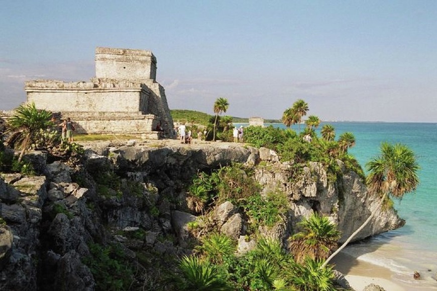
Tulum, Maya city on the coast of the Caribbean in the state of Quintana Roo (Mexico).
Caribbean Sea
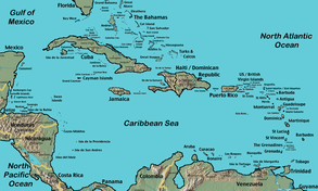
The Caribbean Sea is a sea of the Atlantic Ocean situated in the tropics of the Western hemisphere. It is bounded by Mexico and Central America to the west and southwest, to the north by the Greater Antilles, and to the east by the Lesser Antilles.
The entire area of the Caribbean Sea, the numerous islands of the West Indies, and adjacent coasts, are collectively known as the Caribbean. The Caribbean Sea is one of the largest salt water seas and has an area of about 971,000 sq mi (2,514,878 km2).The sea's deepest point is the Cayman Trough, between the Cayman Islands and Jamaica, at 7,686 m (25,220 ft) below sea level. The Caribbean coastline has many gulfs and bays: the Gulf of Gonâve, Gulf of Venezuela, Gulf of Darién, Golfo de los Mosquitos and Gulf of Honduras.
The entire area of the Caribbean Sea, the numerous islands of the West Indies, and adjacent coasts, are collectively known as the Caribbean. The Caribbean Sea is one of the largest salt water seas and has an area of about 971,000 sq mi (2,514,878 km2).The sea's deepest point is the Cayman Trough, between the Cayman Islands and Jamaica, at 7,686 m (25,220 ft) below sea level. The Caribbean coastline has many gulfs and bays: the Gulf of Gonâve, Gulf of Venezuela, Gulf of Darién, Golfo de los Mosquitos and Gulf of Honduras.
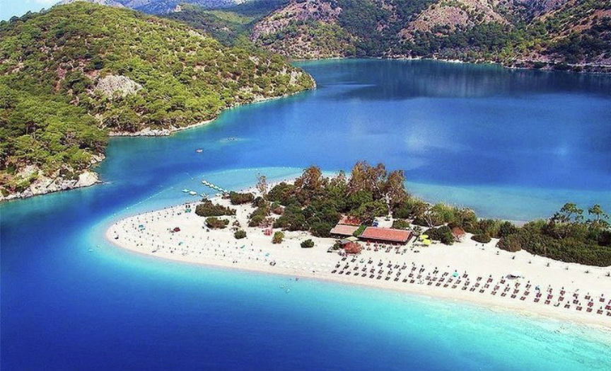
A view across the Ölüdeniz, Turkey,Mediterranean Sea
Mediterranean Sea
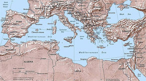
The Mediterranean Sea is a sea connected to the Atlantic Ocean surrounded by the Mediterranean region and almost completely enclosed by land: on the north by Anatolia and Europe, on the south by North Africa, and on the east by the Levant. The sea is technically a part of the Atlantic Ocean, although it is usually identified as a completely separate body of water.
The name Mediterranean is derived from the Latin mediterraneus, meaning "inland" or "in the middle of the earth" (from medius, "middle" and terra, "earth"). It covers an approximate area of 969,000 sq mi (2,509,698 km2) but its connection to the Atlantic (the Strait of Gibraltar) is only 14 km (8.7 mi) wide. In oceanography, it is sometimes called the Eurafrican Mediterranean Sea or the European Mediterranean Sea to distinguish it from mediterranean seas elsewhere.
The Mediterranean Sea has an average depth of 1,500 m (4,900 ft) and the deepest recorded point is 5,267 m (17,280 ft) in the Calypso Deep in the Ionian Sea.
The Mediterranean Sea is connected to the Atlantic Ocean by the Strait of Gibraltar on the west and to the Sea of Marmara and the Black Sea, by the Dardanelles and the Bosporus respectively, on the east. The Sea of Marmara is often considered a part of the Mediterranean Sea, whereas the Black Sea is generally not. The 163 km (101 mi) long man-made Suez Canal in the southeast connects the Mediterranean Sea to the Red Sea.
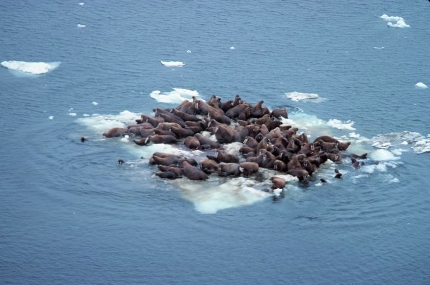
Bering Sea ice, Alaska
Bering Sea
The Bering Sea is a body of water in the Pacific Ocean that comprises a deep water basin, which then rises through a narrow slope into the shallower water above the continental shelves.
The Bering Sea is separated from the Gulf of Alaska by the Alaska Peninsula. It covers over 873,000 sq mi (2,261,060 km2), bordered on the east and northeast by Alaska, on the west by Russia's Siberia and Kamchatka Peninsula, on the south by the Alaska Peninsula and the Aleutian Islands and on the far north by the Bering Strait, which separates the Bering Sea from the Arctic Ocean's Chukchi Sea. Bristol Bay is the portion of the Bering Sea which separates the Alaska Peninsula from mainland Alaska. The Bering Sea is named for Vitus Bering, a Danish navigator in Russian service, who in 1728 was the first European to systematically explore it, sailing from the Pacific Ocean northward to the Arctic Ocean.The Bering Sea ecosystem includes resources within the jurisdiction of the United States and Russia, as well as international waters in the ‘Donut Hole’. The interaction between currents, sea ice, and weather make for a vigorous and productive ecosystem.
The Bering Sea is separated from the Gulf of Alaska by the Alaska Peninsula. It covers over 873,000 sq mi (2,261,060 km2), bordered on the east and northeast by Alaska, on the west by Russia's Siberia and Kamchatka Peninsula, on the south by the Alaska Peninsula and the Aleutian Islands and on the far north by the Bering Strait, which separates the Bering Sea from the Arctic Ocean's Chukchi Sea. Bristol Bay is the portion of the Bering Sea which separates the Alaska Peninsula from mainland Alaska. The Bering Sea is named for Vitus Bering, a Danish navigator in Russian service, who in 1728 was the first European to systematically explore it, sailing from the Pacific Ocean northward to the Arctic Ocean.The Bering Sea ecosystem includes resources within the jurisdiction of the United States and Russia, as well as international waters in the ‘Donut Hole’. The interaction between currents, sea ice, and weather make for a vigorous and productive ecosystem.
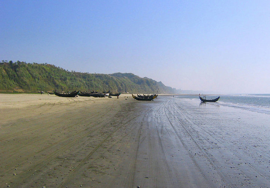
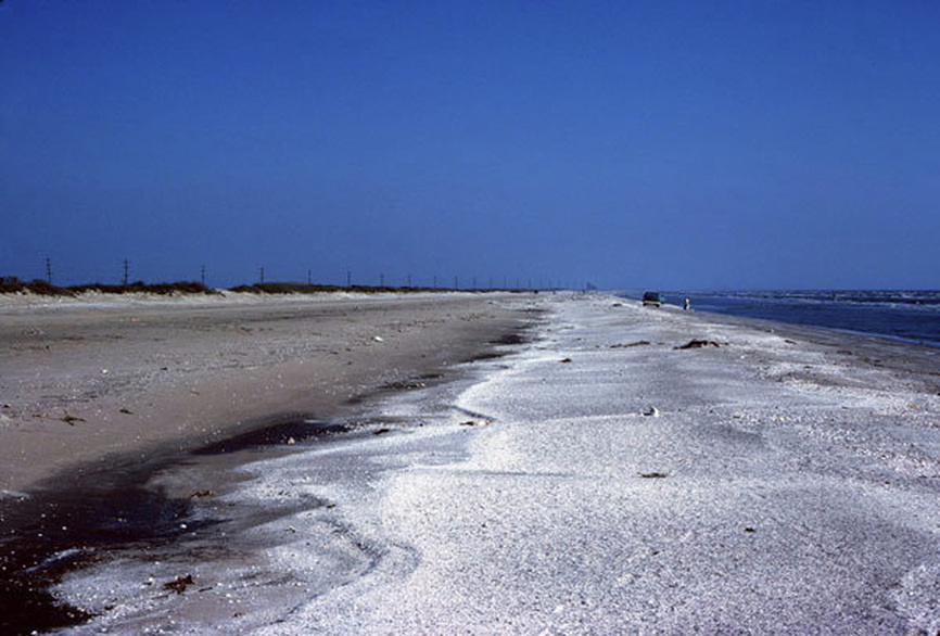
Cox's Bazar,Bangladesh,Bay of Bengal the longest stretch of beach in the world
Bay of Bengal
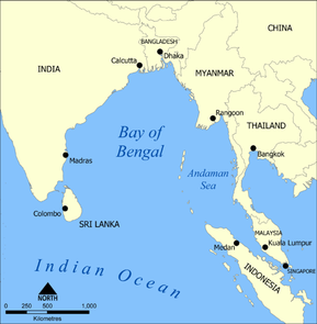
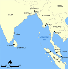
The Bay of Bengal (Bengali: বঙ্গোপসাগর), the largest bay in the world, forms the northeastern part of the Indian Ocean. It resembles a triangle in shape, and is bordered by Bangladesh and the Indian state of West Bengal down to the state of Tamil Nadu,India and Sri Lanka to the west and Burma (Myanmar) and the Andaman and Nicobar Islands to the east.
The Bay of Bengal occupies an area of 838,612 sq mi (2,171,995 km2). A number of large rivers Padma (distributary of Ganges), Meghna (distributary of Brahmaputra), Jamuna (branch of Brahmaputra), Ayeyarwady, Godavari, Mahanadi, Krishna and Kaveri flow into the Bay of Bengal.
Among the important ports are Cuddalore, Ennore, Chennai, Karaikal, Pondicherry, Tuticorin, Kakinada, Machilipatnam, Vishakhapatnam, Paradip, Kolkata, Mongla, Chittagong and Yangon.
Gulf of Mexico
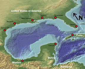
The Gulf of Mexico (Spanish: Golfo de México) is the 12th largest body of water in the world. It is a partially landlocked ocean basin largely surrounded by the North American continent and the island of Cuba.
It is bounded on the northeast, north and northwest by the Gulf Coast of the United States, on the southwest and south by Mexico, and on the southeast by Cuba. The shape of its basin is roughly oval and is approximately 810 nautical miles (1,500 km) wide and filled with sedimentary rocks and debris. It is part of the Atlantic Ocean and is connected to it through the Florida Straits between the U.S. and Cuba, and with the Caribbean Sea (with which it forms the American Mediterranean Sea) via the Yucatan Channel between Mexico and Cuba. With this narrow connection to the Atlantic, the Gulf experiences very small tidal ranges. The size of the Gulf basin is approximately 615,000 mi² (1.6 million km²). Almost half of the basin is shallow continental shelf waters. At its deepest it is 14,383 ft (4,384 m) at the Sigsbee Deep, an irregular trough more than 300 nautical miles (550 km) long. The basin contains a volume of roughly 660 quadrillion gallons (2.5 × 10¹⁵ m3). It was probably formed approximately 300 million years ago as a result of the seafloor sinking. It is one of the world's warmest bodies of water.
It is bounded on the northeast, north and northwest by the Gulf Coast of the United States, on the southwest and south by Mexico, and on the southeast by Cuba. The shape of its basin is roughly oval and is approximately 810 nautical miles (1,500 km) wide and filled with sedimentary rocks and debris. It is part of the Atlantic Ocean and is connected to it through the Florida Straits between the U.S. and Cuba, and with the Caribbean Sea (with which it forms the American Mediterranean Sea) via the Yucatan Channel between Mexico and Cuba. With this narrow connection to the Atlantic, the Gulf experiences very small tidal ranges. The size of the Gulf basin is approximately 615,000 mi² (1.6 million km²). Almost half of the basin is shallow continental shelf waters. At its deepest it is 14,383 ft (4,384 m) at the Sigsbee Deep, an irregular trough more than 300 nautical miles (550 km) long. The basin contains a volume of roughly 660 quadrillion gallons (2.5 × 10¹⁵ m3). It was probably formed approximately 300 million years ago as a result of the seafloor sinking. It is one of the world's warmest bodies of water.
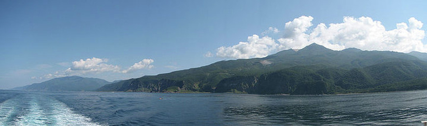
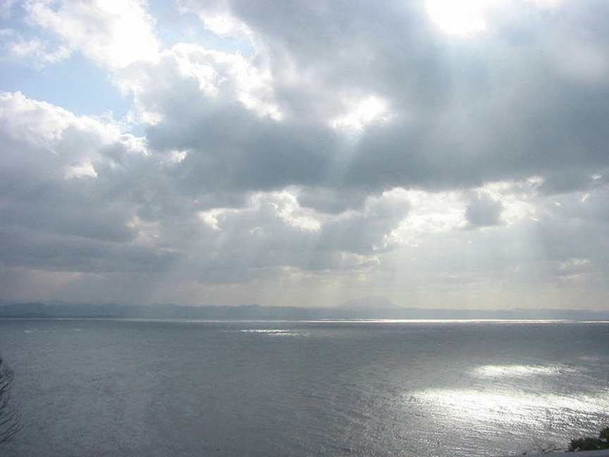
Shiretoko National Park on the Sea of Okhotsk coast of Hokkaido, Japan
Sea of Okhotsk
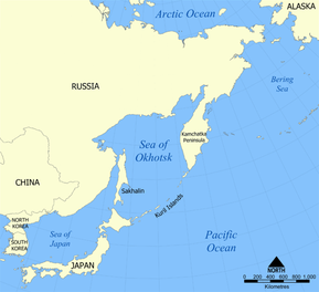
The Sea of Okhotsk (Russian: Охо́тское мо́ре; English Transliteration: Okhotskoye More) is a part of the western Pacific Ocean, lying between the Kamchatka Peninsula on the east, the Kuril Islands on the southeast, the island of Hokkaido to the far south, the island of Sakhalin along the west, and a long stretch of eastern Siberian coast (including the Shantar Islands) along the west and north. The northeast corner is Shelikhov Gulf. It is named after Okhotsk, the first Russian settlement in the Far East.
The Sea of Okhotsk covers 537,000 sq mi (1,390,824 km2) with a mean depth of 2,818 feet (859 metres). Its maximum depth is 11,063 feet (3,372 metres). It is connected to the Sea of Japan on either side of Sakhalin: on the west through the Sakhalin Gulf and the Gulf of Tartary; on the south, through the La Pérouse Strait.
In winter, navigation on the Sea of Okhotsk becomes difficult, or even impossible, due to the formation of large ice floes, because the large amount of freshwater from the Amur River lowers the salinity and raises the freezing point of the sea. The distribution and thickness of ice floes depends on many factors: the location, the time of year, water currents, and the sea temperatures.
With the exception of Hokkaidō, one of the Japanese home islands, the sea is surrounded on all sides by territory administered by the Russian Federation. For this reason, it is generally considered as being under Russian sovereignty.
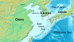
Sea of Japan
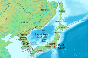
The Sea of Japan is a marginal sea of the western Pacific Ocean, between the Asian mainland, the Japanese archipelago, and Sakhalin. It is bordered by the countries of Japan, North Korea, Russia, and South Korea. Like the Mediterranean Sea, it has almost no tides due to its nearly complete enclosure.A controversy exists about its name, with some wanting to call it the "East Sea". This has been treated differently by different international bodies, the United Nations confirmed its adoption of "Sea of Japan" in its official documents in March 2004, while others like National Geographic have included both names in their maps and articles.
The Sea of Japan is bound by the Russian mainland and Sakhalin island to the north, the Korean Peninsula to the west, and the Japanese islands of Hokkaidō, Honshū, and Kyūshū to the east and south.It is connected to other seas by five shallow straits: the Strait of Tartary between the Asian mainland and Sakhalin; La Pérouse Strait between the islands of Sakhalin and Hokkaidō; the Tsugaru Strait between the islands of Hokkaidō and Honshū; the Kanmon Straits between the islands of Honshū and Kyūshū; and the Korea Strait (genkainada) between the Korean Peninsula and the island of Kyūshū. The Korea Strait is composed of the Western Channel and the Tsushima Strait, on either side of Tsushima Island.
The Sea of Japan is bound by the Russian mainland and Sakhalin island to the north, the Korean Peninsula to the west, and the Japanese islands of Hokkaidō, Honshū, and Kyūshū to the east and south.It is connected to other seas by five shallow straits: the Strait of Tartary between the Asian mainland and Sakhalin; La Pérouse Strait between the islands of Sakhalin and Hokkaidō; the Tsugaru Strait between the islands of Hokkaidō and Honshū; the Kanmon Straits between the islands of Honshū and Kyūshū; and the Korea Strait (genkainada) between the Korean Peninsula and the island of Kyūshū. The Korea Strait is composed of the Western Channel and the Tsushima Strait, on either side of Tsushima Island.
- Greatest depth: 3,742 meters
- Mean depth: 1,753 meters
- Surface area: about 978,000 km²
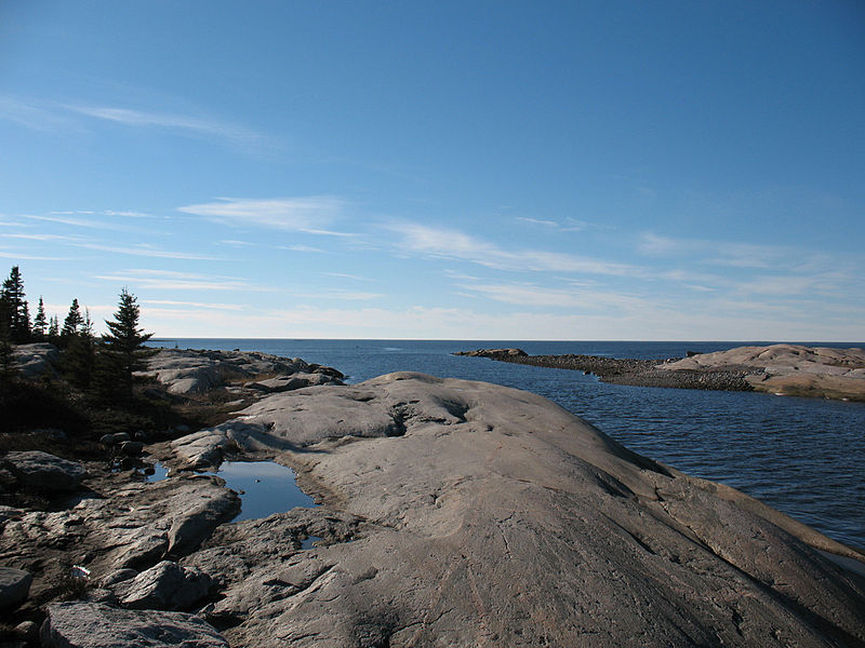
This photo was taken at Longue Pointe in northern Quebec
Hudson Bay
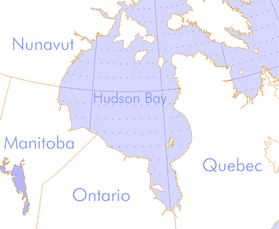
Hudson Bay (French: baie d'Hudson) is a large body of water in northeastern Canada. It drains a very large area that includes parts of Ontario, Quebec,Saskatchewan, Alberta, most of Manitoba, southeastern Nunavut, as well as parts of North Dakota, South Dakota, Minnesota, and Montana. A smaller offshoot of the bay, James Bay, lies to the south.
The Eastern Cree name for Hudson and James Bay is Wînipekw (Southern dialect) or Wînipâkw (Northern dialect), meaning muddy or brackish water.Lake Winnipeg is similarly named by the local Cree, as is the location for the City of Winnipeg.
Hudson Bay is 282,000 sq mi (730,377 km2) making it the second-largest bay in the world (after the Bay of Bengal). It is relatively shallow, with an average depth of about 100 metres (330 ft) (compared to 2,600 meters in the Bay of Bengal). It is approximately 1,370 km (850 mi) long and 1,050 km (650 mi) wide
It was named for the English explorer Henry Hudson, who, in 1610 on the ship Discovery, found the bay and clamed it for England.
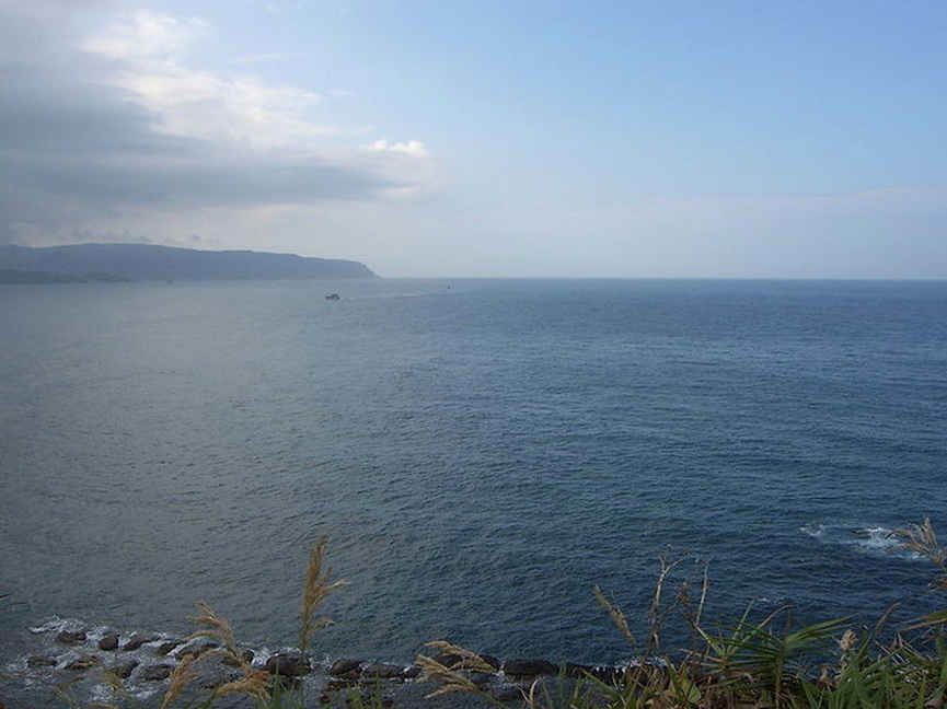
View of East China Sea from Yeliou, Taiwan
East China Sea
The East China Sea is a marginal sea east of China. It is a part of the Pacific Ocean and covers an area of 257,000 sq mi (665,627 km2). In China, the sea is called the East Sea. In Korea, the sea is sometimes called "South Sea", but this is more often used to speak only of the area near South Korea's southern coast.
The East China Sea is bounded on the East by the Kyūshū and Ryūkyū islands, on the South by Taiwan, and on the West by mainland China. It is connected with the South China Sea by the Taiwan Strait and with the Sea of Japan by the Korea Strait; it opens in the North to the Yellow Sea.Territories with borders on the sea (clockwise from north) include: South Korea, Japan, Taiwan, and Mainland China.
The Yangtze River (Chang Jiang) is the largest river flowing into the East China Sea.
Andaman Sea
The Andaman Sea or Burma Sea is a body of water to the southeast of the Bay of Bengal, south of Myanmar, west of Thailand and east of the Andaman Islands, India.It is part of the Indian Ocean.
The average depth of the sea is about 1,000 meters (3,300 ft). The northern and eastern parts are shallower than 180 meters (600 ft) due to the silt deposited by the Irrawaddy River. This major river flows into the sea from the north through Burma. The western and central areas are 900–3,000 meters deep (3,000–10,000 ft). Less than 5% of the sea is deeper than 3,000 meters (10,000 ft), and in a system of submarine valleys east of the Andaman-Nicobar Ridge, the depth exceeds 4,000 meters (13,200 ft).The sea floor is covered with pebbles, gravel and sand.The climate and water salinity of the Andaman Sea are mostly determined by the monsoons of southeast Asia. Air temperature is stable over the year at 26 °C in February and 27 °C in August. Precipitation is as high as 3,000 mm/year and mostly occurs in summer. Sea currents are south-easterly and easterly in winter and south-westerly and westerly in summer. The average surface water temperature is 26–28 °C in February and 29 °C in May. The water temperature is constant at 4.8 °C at the depths of 1,600 m and below. Salinity is 31.5–32.5‰ (parts per thousand) in summer and 30.0–33.0‰ in winter in the southern part. In the northern part, it decreases to 20–25‰ due to the inflow of fresh water from the Irrawaddy River. Tides are semidiurnal (i.e. rising twice a day) with the amplitude of up to 7.2 meters.
The average depth of the sea is about 1,000 meters (3,300 ft). The northern and eastern parts are shallower than 180 meters (600 ft) due to the silt deposited by the Irrawaddy River. This major river flows into the sea from the north through Burma. The western and central areas are 900–3,000 meters deep (3,000–10,000 ft). Less than 5% of the sea is deeper than 3,000 meters (10,000 ft), and in a system of submarine valleys east of the Andaman-Nicobar Ridge, the depth exceeds 4,000 meters (13,200 ft).The sea floor is covered with pebbles, gravel and sand.The climate and water salinity of the Andaman Sea are mostly determined by the monsoons of southeast Asia. Air temperature is stable over the year at 26 °C in February and 27 °C in August. Precipitation is as high as 3,000 mm/year and mostly occurs in summer. Sea currents are south-easterly and easterly in winter and south-westerly and westerly in summer. The average surface water temperature is 26–28 °C in February and 29 °C in May. The water temperature is constant at 4.8 °C at the depths of 1,600 m and below. Salinity is 31.5–32.5‰ (parts per thousand) in summer and 30.0–33.0‰ in winter in the southern part. In the northern part, it decreases to 20–25‰ due to the inflow of fresh water from the Irrawaddy River. Tides are semidiurnal (i.e. rising twice a day) with the amplitude of up to 7.2 meters.
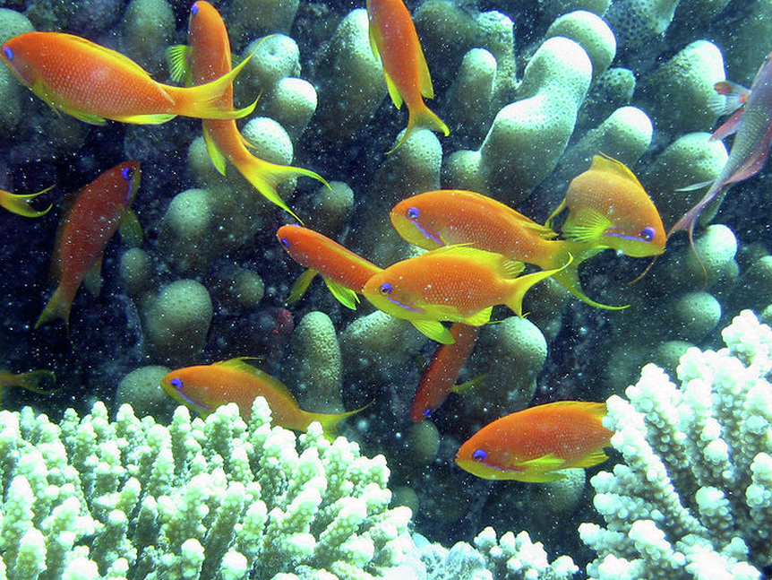
Red Sea coral and marine fish
Red Sea
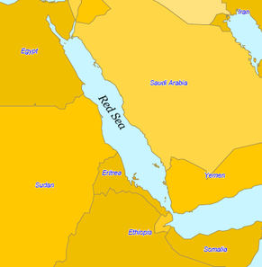
The Red Sea is a seawater inlet of the Indian Ocean, lying between Africa and Asia. Red Sea is a direct translation of the Greek Erythra Thalassa and Latin Mare Rubrum , Arabic Al-Bahr Al-Ahmar (البحر الأحمر) or Bahr Al-Qalzam(بحر القلزم), Somali Badda Cas and Tigrinya Qeyyih bahri (ቀይሕ ባሕሪ).
The connection to the ocean is in the south through the Bab-el-Mandeb strait and the Gulf of Aden. In the north, there is the Sinai Peninsula, the Gulf of Aqaba, and the Gulf of Suez (Leading to the Suez Canal). The Red Sea is a Global 200 ecoregion.Occupying a part of the Great Rift Valley, the Red Sea has a surface area of roughly 175,000 sq mi (453,248 km2).It is about 2250 km (1398 miles) long and, at its widest point, is 355 km (220.6 miles) wide. It has a maximum depth of 2211 metres (7254 feet) in the central median trench, and an average depth of 490 metres (1,608 feet). However, there are also extensive shallow shelves, noted for their marine life and corals. The sea is the habitat of over 1,000 invertebrate species, and 200 soft and hard corals. It is the world's northernmost tropical sea.
The connection to the ocean is in the south through the Bab-el-Mandeb strait and the Gulf of Aden. In the north, there is the Sinai Peninsula, the Gulf of Aqaba, and the Gulf of Suez (Leading to the Suez Canal). The Red Sea is a Global 200 ecoregion.Occupying a part of the Great Rift Valley, the Red Sea has a surface area of roughly 175,000 sq mi (453,248 km2).It is about 2250 km (1398 miles) long and, at its widest point, is 355 km (220.6 miles) wide. It has a maximum depth of 2211 metres (7254 feet) in the central median trench, and an average depth of 490 metres (1,608 feet). However, there are also extensive shallow shelves, noted for their marine life and corals. The sea is the habitat of over 1,000 invertebrate species, and 200 soft and hard corals. It is the world's northernmost tropical sea.
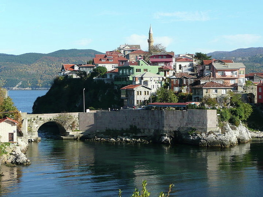
Amasra is located in small island in Black Sea
Black Sea
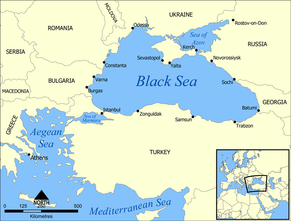
The Black Sea is an inland sea bounded by Europe, Anatolia and the Caucasus and is ultimately connected to the Atlantic Ocean via theMediterranean and Aegean Seas and various straits. The Bosphorus strait connects it to the Sea of Marmara, and the strait of the Dardanelles connects it to the Aegean Sea region of the Mediterranean. These waters separate eastern Europe and western Asia. The Black Sea also connects to the Sea of Azov by the Strait of Kerch.
The Black Sea got its name from the Ottoman Turks.'Kara (Black)' denotes 'North' in Medieval Turkish, as in Kara Denizi- Kara Sea north of Siberian Yakut Turks, similar to Black Sea. The Black Sea is one of four seas named in English after common color terms the others being the Red Sea, the White Sea and the Yellow Sea.
The Black Sea has an area of 436,400 km2 (168,495.0 sq mi) (Non-include Sea of Azov),a maximum depth of 2,206 m (7,238 ft),and a volume of 547,000 km3 (131,200 cu mi).The Black Sea forms in an east-west trending elliptical depression which lies between Bulgaria, Georgia, Romania, Russia, Turkey, and Ukraine.It is constrained by the Pontic Mountains to the south, the Caucasus Mountains to the east and features a wide shelf to the north-west. The longest east-west extent is about 1,175 km.
Important cities along the coast include Batumi, Burgas, Constanţa, Giresun, Istanbul, Kerch, Kherson, Mangalia, Năvodari, Novorossiysk, Odessa, Ordu, Poti, Rize, Samsun, Sevastopol, Sochi, Sukhumi, Trabzon, Varna, Yalta and Zonguldak.
The German North Sea coast
North Sea
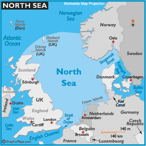
The North Sea is a marginal, epeiric sea on the European continental shelf. The Dover Strait and the English Channel in the south and the Norwegian Sea in the north connect it to the Atlantic Ocean. It is more than 970 kilometres (600 mi) long and 580 kilometres (360 mi) wide, with an area of around 165,000 sq mi (427,348 km2). A large part of the European drainage basin empties into the North Sea including water from the Baltic Sea.
The North Sea is bounded by the Orkney Islands and east coasts of England and Scotland to the west and the northern and central European mainland to the east and south, including Norway, Denmark, Germany, the Netherlands, Belgium, and France.In the southwest, beyond the Straits of Dover, the North Sea becomes the English Channel connecting to the Atlantic Ocean.In the east, it connects to the Baltic Sea via the Skagerrak and Kattegat, narrow straits that separate Denmark from Norway and Sweden respectively.In the north it is bordered by the Shetland Islands, and connects with the Norwegian Sea, which lies in the very north-eastern part of the Atlantic.
It is more than 970 kilometres (600 mi) long and 580 kilometres (360 mi) wide, with an area of 165,000 sq mi (427,348 km2) and a volume of 94,000 cubic kilometres (23,000 cu mi).Around the edges of the North Sea are sizeable islands and archipelagos, including Shetland, Orkney, and the Frisian Islands.The North Sea receives freshwater from a number of European continental watersheds, as well as the British Isles island watersheds. A large part of the European drainage basin empties into the North Sea including water from the Baltic Sea. The largest and most important affecting the North Sea are the Elbe and the Rhine Meuse watershed.Around 184 million people live in the catchment area of the rivers that flow into the North Sea encompassing some highly industrialized areas.
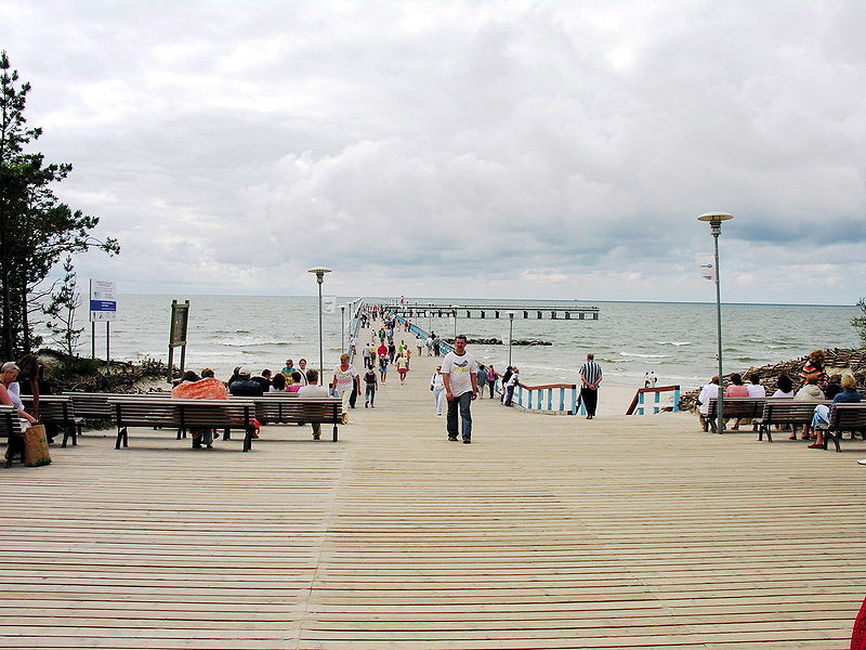
Pedestrian pier at Palanga, the most popular sea resort in Lithuania at the shore of Baltic sea
Baltic Sea
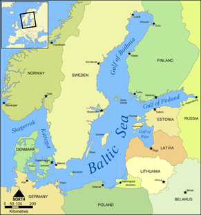
The Baltic Sea is a brackish mediterranean sea located in Northern Europe, from 53°N to 66°N latitude and from 20°E to 26°E longitude. It is bounded by the Scandinavian Peninsula, the mainland of Europe, and the Danish islands. It drains into the Kattegat by way of the Øresund, the Great Belt and theLittle Belt. The Kattegat continues through Skagerrak into the North Sea and the Atlantic Ocean. The Baltic Sea is connected by man-made waterways to the White Sea via the White Sea Canal, and to the North Sea via the Kiel Canal. The Baltic Sea might be considered to be bordered on its northern edge by the Gulf of Bothnia, on its northeastern edge by the Gulf of Finland, and on its eastern edge by the Gulf of Riga. However, these various gulfs can be considered to be simply offshoots of the Baltic Sea, and therefore parts of it.
The Baltic sea is about 1600 km (1000 mi) long, an average of 193 km (120 mi) wide, and an average of 55 m (180 ft, 30 fathoms) deep. The maximum depth is 459 m (1506 ft), on the Swedish side of the center. The surface area is about 147,000 sq mi (380,728 km2) and the volume is about 20,000 km³ (5040 cubic miles). The periphery amounts to about 8000 km (4968 mi) of coastline.
The Baltic sea is about 1600 km (1000 mi) long, an average of 193 km (120 mi) wide, and an average of 55 m (180 ft, 30 fathoms) deep. The maximum depth is 459 m (1506 ft), on the Swedish side of the center. The surface area is about 147,000 sq mi (380,728 km2) and the volume is about 20,000 km³ (5040 cubic miles). The periphery amounts to about 8000 km (4968 mi) of coastline.
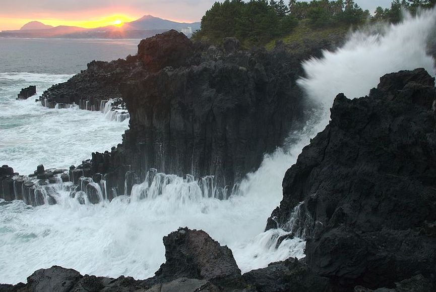
Yellow Sea at Jeju-do island
Yellow Sea
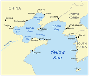
The Yellow Sea is the name given to the northern part of the East China Sea, which is a marginal sea of the Pacific Ocean. It is located between mainland China and the Korean peninsula. Its name comes from the sand particles from Gobi Desert sand storms that turn the surface of the water golden yellow during sunset and can be seen while sailing or flying west. In North Korea and South Korea, the sea is sometimes called the West Sea.
The innermost bay of the Yellow Sea is called the Bohai Sea (previously Pechihli Bay or Chihli Bay). Into it flow both the Yellow River (through Shandong province and its capital Jinan) and Hai He (through Beijing and Tianjin).The Yellow Sea is one of four seas named in English after common color terms the others being the Black Sea, the Red Sea and the White Sea.
The Yellow Sea, excluding the Bohai, has an area of 113,500 sq mi (293,964 km2).Its mean depth is only 44m, with a maximum depth of 152m.The sea is a flooded section of continental shelf, that formed after the last ice age (some 10,000 years ago) as sea levels rose 120m to their current levels.
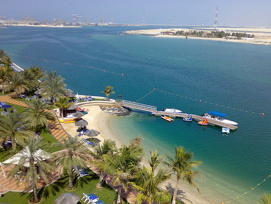
Abu Dhabi beach view
Persian Gulf
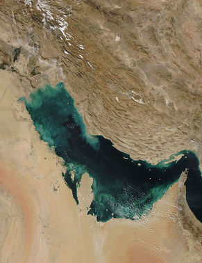
The Persian Gulf, in Southwest Asia, is an extension of the Indian Ocean located between Iran and the Arabian Peninsula.Historically and commonly known as the Persian Gulf, this body of water is also controversially referred to as the Arabian Gulf or simply The Gulf by most Arab states,and Gulf of Basra by Turkey, although none of the latter three terms is recognized internationally.
This inland sea of some 88,800 sq mi (229,991 km2) is connected to the Gulf of Oman in the east by the Strait of Hormuz;and its western end is marked by the major river delta of the Shatt al-Arab, which carries the waters of the Euphrates and the Tigris. Its length is 989 kilometres, with Iran covering most of the northern coast and Saudi Arabia most of the southern coast. The Persian Gulf is about 56 kilometres wide at its narrowest, in the Strait of Hormuz. The waters are overall very shallow, with a maximum depth of 90 metres and an average depth of 50 metres.
Countries with a coastline on the Persian Gulf are (clockwise, from the north): Iran, Oman (exclave of Musandam), United Arab Emirates, Saudi Arabia ,Qatar on a peninsula off the Saudi coast, Bahrain on an island, Kuwait and Iraq in the northwest. Various small islands lie within the Persian Gulf, some of which are subject to territorial disputes by the states of the region.
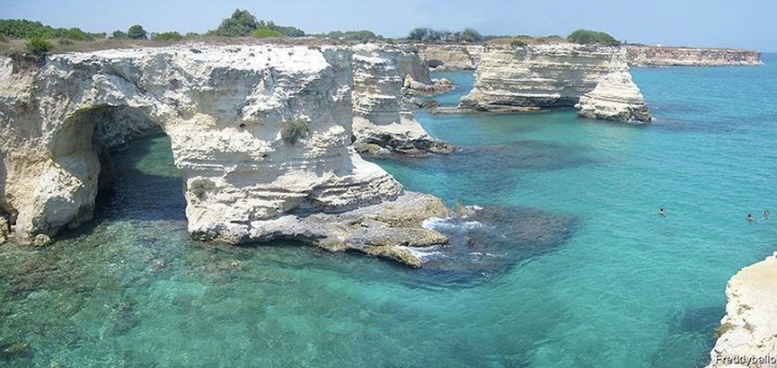
Torre Sant'Andrea, Salento (Italy)
Adriatic Sea
The Adriatic Sea is a body of water and is a part of the Mediterranean Sea. The sea separates the Italian Peninsula from the Balkan Peninsula, and the system of the Apennine Mountains from that of the Dinaric Alps and adjacent ranges. Countries that have a coastline in the Adriatic Sea are Italy, Slovenia, Croatia, Bosnia and Herzegovina, Montenegro and Albania.
The western coast is Italian, while the eastern coast runs along Slovenia (47 km), Croatia (5,835 km) , Bosnia and Herzegovina (26 km), Montenegro (294 km), and Albania (295 km). Major rivers joining the Adriatic are the Reno, Po, Adige/Etsch, Brenta, Piave, Soča/Isonzo, Zrmanja, Krka, Cetina, Neretva, and Drin (Drini).
It area is 60,000 sq mi (155,399 km2).The average width of the sea is about 160 km. The Strait of Otranto joins the Adriatic Sea and the Ionian Sea and is only 85 to 100 km wide. The sea is very shallow. Its average depth is 240 m (133 fathoms). The sea is deepest east of Monte Gargano and south of Dubrovnik where it dips below 1,460 m (800 fathoms).
