
Deserts Of Pakistan
Thar Desert
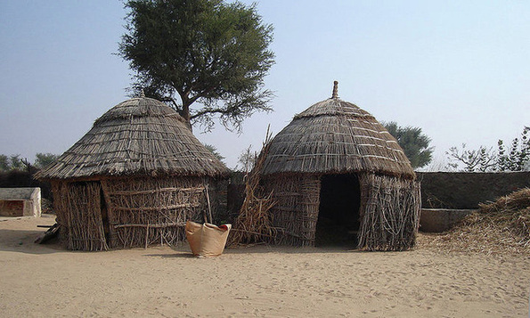
A house in the Thar desert
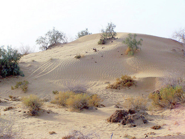
The Thar Desert (Rajasthani: थार मरुधर) (also known as the Great Indian Desert), is a large, arid region in the northwestern part of the Indian subcontinent. With an area of more than 200,000 km2 (77,000 sq mi),it is the world's 9th largest subtropical desert and world 18 largest desert and pakistan largest desert.
It lies mostly in the Indian state of Rajasthan, and extends into the southern portion of Haryana and Punjab states and into northern Gujarat state. In Pakistan, the desert covers eastern Sindh province and the southeastern portion of Pakistan's Punjab province. The Cholistan Desert adjoins the Thar desert spreading into Pakistani Punjab province.
In India the thar desert extends from the Sutlej River, surrounded by the Aravalli Range on the east, on the south by the salt marsh known as the Rann of Kutch (Parts of which are sometimes included in the Thar), and on the west by the Indus River. Its boundary to the large thorny steppe to the north is ill-defined. , about 3/5th of the total geographical area of the state. In Pakistan, the desert covers the eastern Sindh province and the southeastern portion of Pakistan's Punjab province. The Tharparkar District is one of the major parts of the desert area. Tharparkar consists of two words, Thar means ‘desert’ while Parkar stands for ‘the other side’. Years back, it was known as Thar and Parkar but subsequently became just one word ‘Tharparkar’ for the two distinct parts of Sindh province. On the western side, Parkar is the irrigated area whereas Thar, the eastern part, is known as the largest desert of Pakistan. Rainfall in the area is very low, from 100-500mm per year all falling between July and September, and the climate is harsh with temperatures ranging form near freezing up to 50°C.
There are three principal landforms in the desert region the predominantly sand covered Thar, the plains with hills including the central dune free country and the semi-arid area surrounding the Aravalli range.
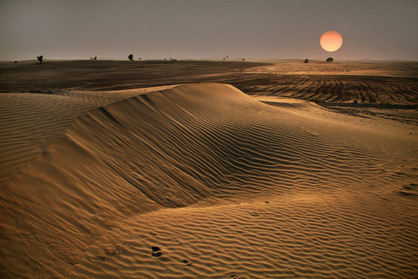
On the whole the Thar Desert slopes imperceptibly towards the Indus Plain and surface unevenness is mainly due to sand dunes. The dunes in the south are higher, rising sometimes to 150 m whereas in the north they are lower and rise to 16 m above the ground level.The Aravalli forms the main landmark to the south-east of Thar Desert. Desert soil - The soils of the Arid Zone are generally sandy to sandy-loam in texture. The consistency and depth vary according to the topographical features. The low-lying loams are heavier and may have a hard panSome of these soils contain a high percentage of soluble salts in the lower horizons, turning water in the wells poisonous. Being poor in organic matter they show a low loss on ignition.
It lies mostly in the Indian state of Rajasthan, and extends into the southern portion of Haryana and Punjab states and into northern Gujarat state. In Pakistan, the desert covers eastern Sindh province and the southeastern portion of Pakistan's Punjab province. The Cholistan Desert adjoins the Thar desert spreading into Pakistani Punjab province.
In India the thar desert extends from the Sutlej River, surrounded by the Aravalli Range on the east, on the south by the salt marsh known as the Rann of Kutch (Parts of which are sometimes included in the Thar), and on the west by the Indus River. Its boundary to the large thorny steppe to the north is ill-defined. , about 3/5th of the total geographical area of the state. In Pakistan, the desert covers the eastern Sindh province and the southeastern portion of Pakistan's Punjab province. The Tharparkar District is one of the major parts of the desert area. Tharparkar consists of two words, Thar means ‘desert’ while Parkar stands for ‘the other side’. Years back, it was known as Thar and Parkar but subsequently became just one word ‘Tharparkar’ for the two distinct parts of Sindh province. On the western side, Parkar is the irrigated area whereas Thar, the eastern part, is known as the largest desert of Pakistan. Rainfall in the area is very low, from 100-500mm per year all falling between July and September, and the climate is harsh with temperatures ranging form near freezing up to 50°C.
There are three principal landforms in the desert region the predominantly sand covered Thar, the plains with hills including the central dune free country and the semi-arid area surrounding the Aravalli range.
On the whole the Thar Desert slopes imperceptibly towards the Indus Plain and surface unevenness is mainly due to sand dunes. The dunes in the south are higher, rising sometimes to 150 m whereas in the north they are lower and rise to 16 m above the ground level.The Aravalli forms the main landmark to the south-east of Thar Desert. Desert soil - The soils of the Arid Zone are generally sandy to sandy-loam in texture. The consistency and depth vary according to the topographical features. The low-lying loams are heavier and may have a hard panSome of these soils contain a high percentage of soluble salts in the lower horizons, turning water in the wells poisonous. Being poor in organic matter they show a low loss on ignition.
Cholistan Desert
Cholistan Desert, Punjab, Pakistan
Cholistan Desert (Urdu: صحرائے چولستان), also locally known as Rohi) sprawls thirty kilometers from Bahawalpur, Punjab, Pakistan and covers an area of 26,300 km². It adjoins the Thar Desert extending over to Sindh and into India.
The word Cholistan is derived from the Turkish word Chol, which means Desert. Cholistan thus means Land of the Desert. The people of Cholistan lead a semi-nomadic life, moving from one place to another in search of water and fodder for their animals. The dry bed of the Hakra River runs through the area, along which many settlements of the Indus Valley Civilisation have been found.
The Desert also has an Annual Jeep Rally, known as Cholistan Desert Jeep Rally. It is the biggest motor sports event in Pakistan.
Thal Desert
The Thal desert is situated in Punjab, Pakistan. It is vast area mainly between the Jhelum and Sindh rivers near the Pothohar Plateau. Its total length from north to south is 190 miles, and its maximum breadth is 70 miles (110 km) while minimum breadth is 20 miles. This region is divided into the districts of Bhakkar, Khushab, Mianwali, Jhang, Layyah, and Muzaffargarh. Its part in Jhang is on the left bank of the river Jhelum. Geographically, it resembles the deserts of Cholistan and Thar.main town of Thar are Roda Thal, Mankera, Hayderabad Thal, Dullewala,Mehmood Shaheed, Shah Wala, Shahi Shumali, Piplan, Kundiyan, Koat Aazam, Sarauy Muhajir,Jiasal , Rang Pur,Aadhi Koat, Jandan Wala, Mari Shah Sakhira,Noor Pur Thal, and Muzafar Garh. The local population of Thal Desert is Seraiki Speaking where as Punjabi is also spoken. Main tribes of people living there include Cheenna(Jutt),Naich (Jutt), Aheer, Bhachar, Johiya, Mammak, Chhina, Baloch, Tiwana, Sial, Baghoor,Awans, Rahdari, Lashari, Jhammat, Gahi, and Waghra's.
Kharan Desert
Kharan Desert (Urdu: خاران) is a mountainous desert located in Kharan District, Balochistan, Pakistan. Kharan desert is Pakistan's second nuclear test site, operated by the PAEC. Most of its territory was in the Sandy Desert, but included also parts of the Central Makran Range.
