
Lowest Point By Continent
|
|
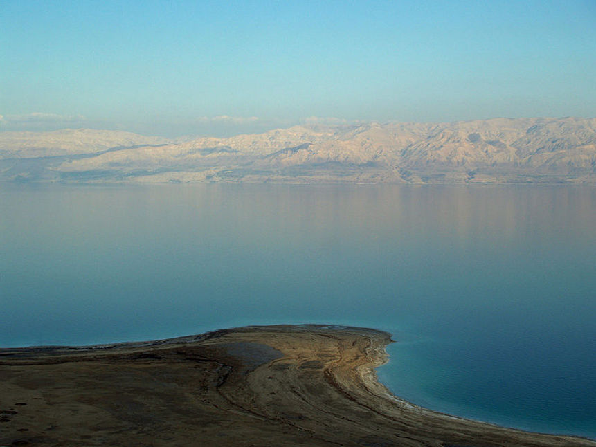
A view from the Israeli side looking across to Jordan
Dead Sea Lowest Point In Asia
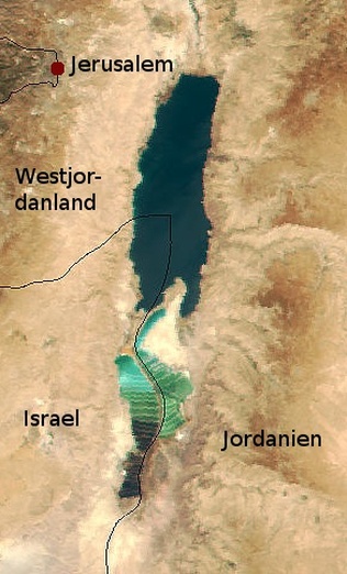
The Dead Sea (Arabic: البحر الميت Al-Bahr al-Mayyit or less commonly bahr lut,بحر لوط, "the Sea of Lot", Hebrew: Yam Ha-Melah, "Sea of Salt",Urdu بحیرہ مردار), also called the Salt Sea, is a salt lake bordering Jordan to the east and Israel and the West Bank to the west.
Its surface and shores are 422 metres (1,385 ft) below sea level,the lowest elevation on the Earth's surface on dry land. The Dead Sea is 378 m (1,240 ft) deep, the deepest hypersaline lake in the world. It is 8.6 or 9 times more salty than the ocean.This salinity makes for a harsh environment where animals cannot flourish, hence its name. The Dead Sea is 67 kilometres (42 mi) long and 18 kilometres (11 mi) wide at its widest point. It lies in the Jordan Rift Valley, and its main tributary is the Jordan River.
The Dead Sea has attracted visitors from around the Mediterranean basin for thousands of years. It was one of the world's first health resorts (for Herod the Great), and it has been the supplier of a wide variety of products, from balms for Egyptian mummification to potash (Potassium,K) for fertilizers. People also use the salt and the minerals from the Dead Sea to create cosmetics and herbal sachets. In 2009, 1.2 million foreign tourists visited on the Israeli side.
The sea has a density of 1.24 kg/L, making swimming difficult but providing a relaxing floating experience for tourists.
Climate
The Dead Sea's climate offers year-round sunny skies and dry air. It has less than 100 millimetres (3.94 in) mean annual rainfall and a summer average temperature between 32 and 39 °C (90 and 102 °F). Winter average temperatures range between 20 and 23 °C (68 and 73 °F).
Religious View
According to the tradition of Islam, the Dead Sea was near the land in which the Prophet Lut lived. The people in this area were considered wicked for their acts of homosexuality, robbery and murder, and therefore Allah had ordained punishment to the people of Lut for these deeds. The punishment arrived when three angels in the form of handsome men were sent down by Allah as guests for Lut to host. When Lut's people heard of the men, they rushed to Lut's house and said that those men were very handsome and they wanted to marry them. This was the final test for the people of Lut in which they failed, so the angel Jibrail raised the land where the prophet's people lived, tipped it upside down and threw it back on earth, causing the ground near the impact to cave in. Thus, the lowest land on Earth was formed because of this punishment. The non-believers (in the monotheism doctrine) were destroyed and the followers were saved.
Modern times
Explorers and scientists arrived in the area to analyze the minerals and research the unique climate. In the late 1940s and early 1950s, hundreds of religious documents dated between 150 BCE and 70 CE were found in caves near the ancient settlement of Qumran, about a mile inland from the northwestern shore of the Dead Sea (presently in the West Bank). They became known and famous as the Dead Sea Scrolls. A golf course named for Sodom and Gomorrah was built by the British at Kalia on the northern shore.
The world's lowest road, Highway 90, runs along the Israeli and West Bank shores of the Dead Sea at 393 m (1,289 ft) below sea level.
The first major hotels were built in nearby Arad, and since the 1960s at the Neve Zohar resort complex. On Jordanian side, three international franchises have opened seaside resort hotels near the King Hussein Bin Talal Convention Center along the eastern coast of the Dead Sea.
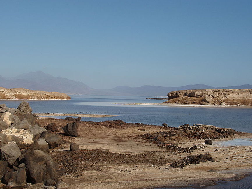
Lake Assal
Lake Assal Lowest Point In Africa
Lake Assal (French: Lac Assal) is a crater lake (A crater lake is a lake that forms in a volcanic crater or caldera, such as a maar, or in an impact crater caused by a meteorite) in central Djibouti, located at the southern border of Tadjoura Region, touching Dikhil Region, some 120 km (75 mi) west of Djibouti city (Capital of the Republic of Djibouti). It lies 155 m (509 ft) below sea level in the Afar Depression and its shores comprise the lowest point on land in Africa and the second lowest land depression on Earth after the Dead Sea. It measures 19 by 7 km (4.3 mi) and has an area of 54 km2 (21 sq mi). The maximum depth is 40 m (130 ft), whereas the mean depth is 7.4 m (24 ft), which makes for a water volume of 400 million cubic metres (320,000 acre·ft). The catchment area measures 900 km2 (350 sq mi), and there is just a residual runoff of fresh water into the lake.
Lake Assal is considered the most saline body of water on earth outside Antarctica, with 34.8 percent salt concentration (up to 40% at 20 m (66 ft) depth), similar to Garabogazköl and higher than the 33.7 percent level in the Dead Sea (often incorrectly considered the world's most saline lake), and an average of 3.5 percent in the world's oceans. Only some hypersaline lakes of the McMurdo Dry Valleys in Antarctica such as Don Juan Pond have a higher salinity.
One thing that makes Assal unique is that, unlike the other major hypersaline lakes of the world, its major source of water is not from incoming streams. The sources of the lake are hot springs whose salinity is close to sea water, which are fed by the Gulf of Tadjoura (French: Golfe de Tadjoura), the western extension of the Gulf of Aden, specifically the nearly closed-off bay Ghoubet Kharab, about 10 km southeast of the lake.
The area is wild and desert-like, and no fauna or flora can be seen in the syrupy waters of the lake. The high temperature of the water (33-34 °C) favors evaporation, and it is surrounded by a salt pan (extending west and mainly northwest). The salt is mined and transported by caravan to Ethiopia.
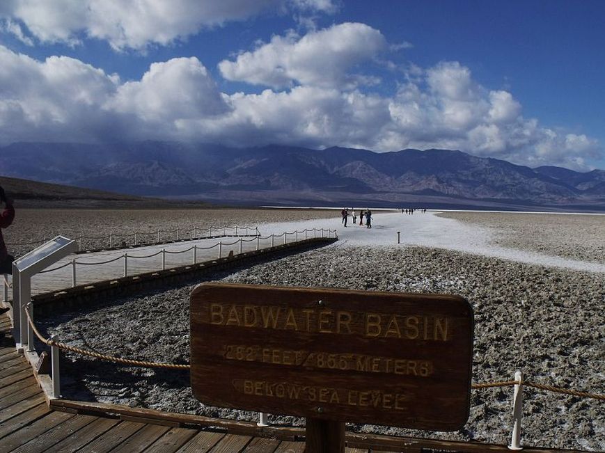
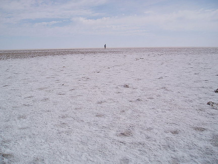
In Death Valley National Park.
Badwater Basin Lowest Point In North America
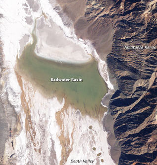
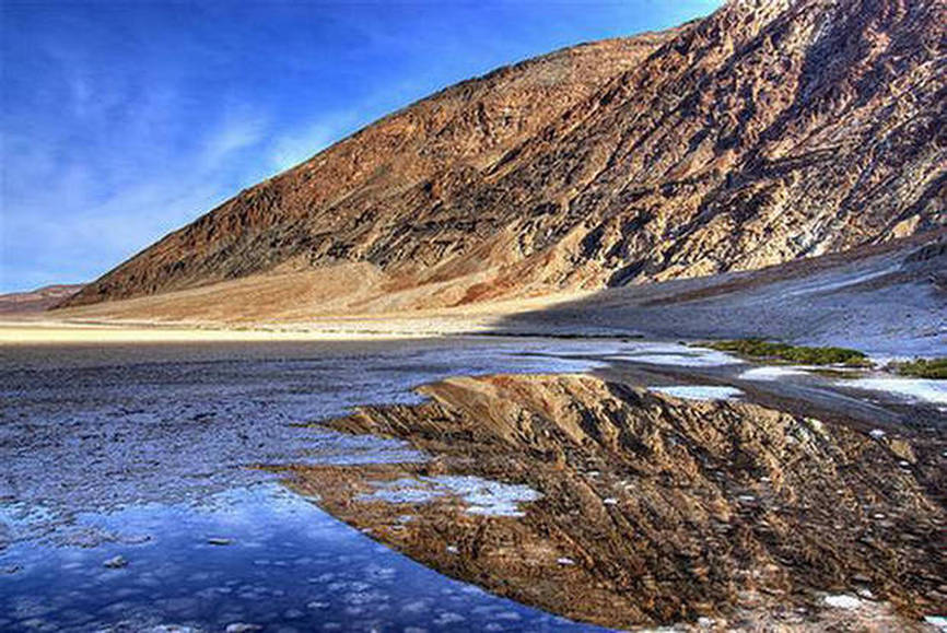
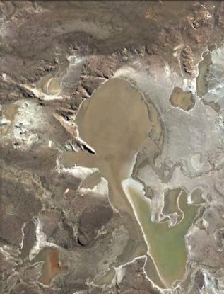
Badwater Basin is an endorheic basin in Death Valley National Park, Death Valley, Inyo County, California, noted as the lowest point in North America, with an elevation of 282 ft (86 m) below sea level.
The site itself consists of a small spring-fed pool of "bad water" next to the road in a sink; the accumulated salts of the surrounding basin make it undrinkable, thus giving it the name. The pool does have animal and plant life, including pickleweed, aquatic insects, and the Badwater snail.
Adjacent to the pool, where water is not always present at the surface, repeated freeze–thaw and evaporation cycles gradually push the thin salt crust into hexagonal honeycomb shapes.
The pool itself is not actually the lowest point of the basin: the lowest point (which is only slightly lower) is several miles to the west and varies in position. However, the salt flats are hazardous to traverse (in many cases being only a thin white crust over mud), and so the sign is at the pool. The area is often mistakenly described as the lowest elevation in the Western Hemisphere, however, the record goes to Laguna del Carbón in Argentina at -105 m (−344 ft).
At Badwater, significant rainstorms flood the valley bottom periodically, covering the salt pan with a thin sheet of standing water. Each newly-formed lake does not last long though, because the 1.9 in (48 mm) of average rainfall is overwhelmed by a 150 in (3,800 mm) annual evaporation rate. This, the United States' greatest evaporation potential, means that even a 12-foot-deep, 30-mile-long lake would dry up in a single year. While the basin is flooded, some of the salt is dissolved; it is redeposited as clean crystals when the water evaporates.
A popular site for tourists is the sign marking "sea level" on the cliff above Badwater.
Laguna del carbon Lowest Point In South America
Laguna del Carbón (Spanish: Coal Lagoon) is an endorheic salt lake in the Gran Bajo de San Julián (Great San Julián Depression) of Santa Cruz Province, Argentina, 54 km from Puerto San Julián. At 105 metres (344 ft) below sea level, it is the lowest point of both the Western and Southern Hemispheres, and the seventh lowest point on Earth.As in several other locations in Patagonia, dinosaur fossils have been found in the area.
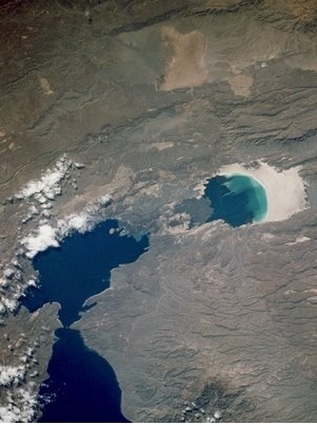
Lake Eyre salt crust
Lake Eyre Lowest Point In Australia
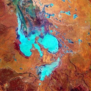
Lake Eyre is the lowest point in Australia, at approximately 15 m (49 ft) (AHD) below sea level, and, on the rare occasions that it fills, it is the largest lake in Australia. It is the focal point of the vast Lake Eyre Basin and is found some 700 km (435 mi) north of Adelaide.
The lake was named after Edward John Eyre who was the first European to sight it in 1840. It is located in the deserts of central Australia, in northern South Australia. The Eyre Basin is a large endorheic system surrounding the lakebed, the lowest part of which is filled with the characteristic salt pan caused by the seasonal expansion and subsequent evaporation of the trapped waters. Even in the dry season there is usually some water remaining in Lake Eyre, normally collecting in a number of smaller sub-lakes on the playa.
Typically a 1.5 m (5 ft) flood occurs every three years, a 4 m (13 ft) flood every decade, and a fill or near fill four times a century. The water in the lake soon evaporates with a minor and medium flood drying by the end of the following summer.

An aerial view of the southern Caspian coast as viewed from atop the Alborz mountains in Mazandaran, Iran
The Caspian Sea Lowest Point In Europe
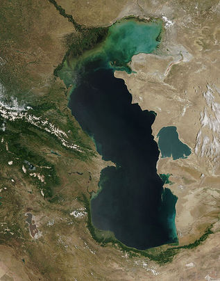
The Caspian Sea Persian: دریای خزر or دریای مازندران, Russian: Каспийское море, Kazakh: Каспий теңізі, Turkmen: Hazar deňzi,Azerbaijani: Xəzər dənizi) is the largest enclosed body of water on Earth by area, variously classed as the world's largest lake or a full-fledged sea.The sea has a surface area of 371,000 km2 (143,200 sq mi) (Not including Garabogazköl Aylagy) and a volume of 78,200 km3 (18,800 cu mi).It is in an endorheic basin (it has no outflows) and is bounded by northern Iran, southern Russia, western Kazakhstan and Turkmenistan, and eastern Azerbaijan.
The ancient inhabitants of its littoral perceived the Caspian Sea as an ocean, probably because of its saltiness and seeming boundlessness. It has a salinity of approximately 1.2%, about a third the salinity of most seawater. The Caspian Sea has been called Gilan (جیلان or بحر جیلان) on ancient maps. In Iran, it is sometimes referred to as Daryâ-ye Mazandaran (دریای مازندران), meaning "the Sea of Mazandaran" in Persian.
Over 130 rivers provide inflow to the Caspian, with the Volga River being the largest. A second affluent, the Ural River, flows in from the north, and the Kura River flows into the sea from the west. In the past, the Amu Darya (Oxus) of Central Asia in the east often changed course to empty into the Caspian through a now-desiccated riverbed called the Uzboy River, as did the Syr Darya farther north. The Caspian also has several small islands; they are primarily located in the North and have a collective land area of roughly 2,000 km2 (770 sq mi). Adjacent to the North Caspian is the Caspian Depression, a low-lying region 28 metres (92 ft) below sea level.Is the lowest point in europe.
